


Living in Four Seasons at Once: Mastering Colombia's Vertical Climate Zones
Most countries ask you to pack for one climate, maybe two. Colombia demands you prepare for practically everything Earth has to offer, often within a single day's journey. This isn't about seasonal variation—Colombia sits near the equator where seasons barely exist. Instead, altitude creates climate zones so dramatically different that you can breakfast in tropical heat, lunch in eternal spring, and have dinner where frost threatens overnight. Understanding these vertical climate zones transforms Colombia from confusing to conquerable, turning what bewilders many first-time visitors into the country's secret advantage.
The concept is elegantly simple: for every 1,000 meters you climb in Colombia, the temperature drops roughly 6°C (about 11°F). Since Colombia's topography ranges from sea level Caribbean beaches to Andean peaks above 5,700 meters, you're looking at temperature variations exceeding 30°C (54°F) without changing countries or waiting for seasons. Colombians have organized their entire civilization around this reality, naming distinct climate zones that determine everything from what crops grow to how people build houses to what clothes hang in closets.
Understanding Colombia's Thermal Floors
Colombians divide their country into five pisos térmicos (thermal floors), each with characteristic temperatures, ecosystems, and cultures. This isn't abstract geography—it's practical knowledge that affects every travel decision you'll make.
Tierra Caliente (Hot Land): 0-1,000 meters
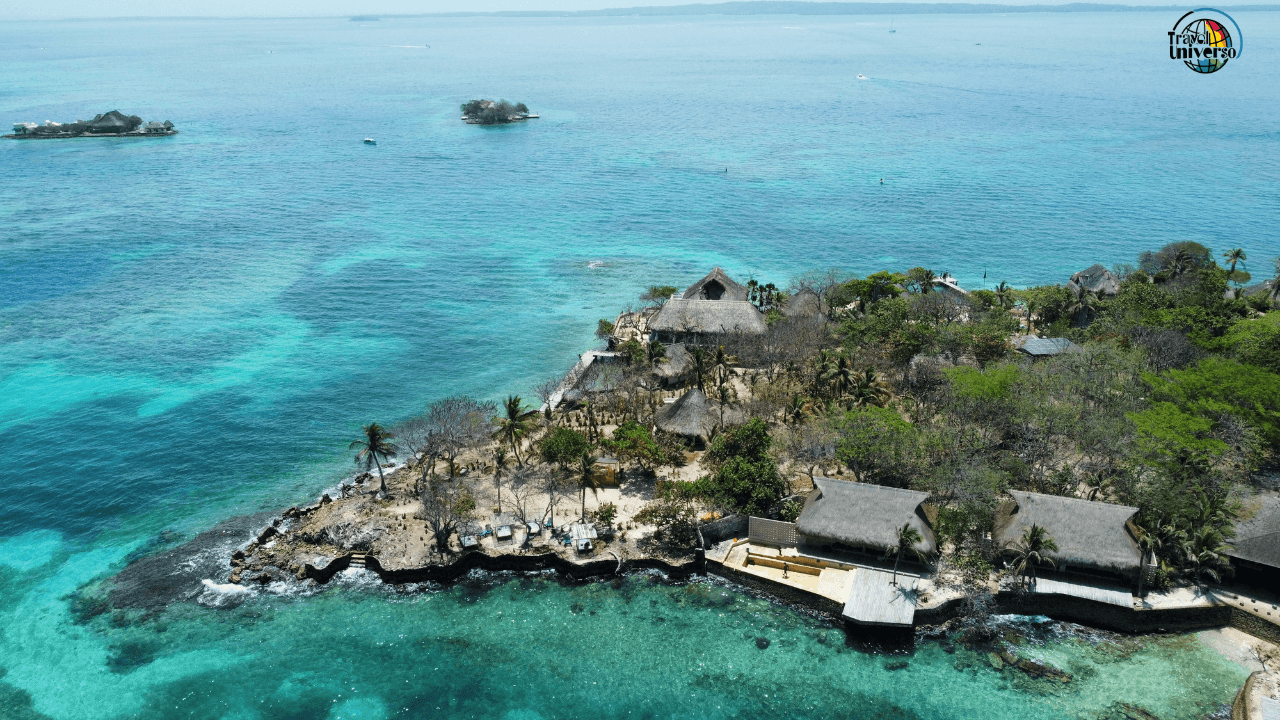
This is tropical Colombia—hot, humid, and vibrant. Temperatures stay consistently between 24-30°C (75-86°F) year-round with high humidity. This zone covers the Caribbean and Pacific coasts, the Amazon basin, much of the eastern Llanos (plains), and river valleys throughout the country.
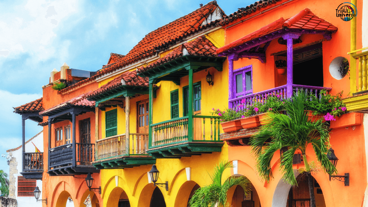
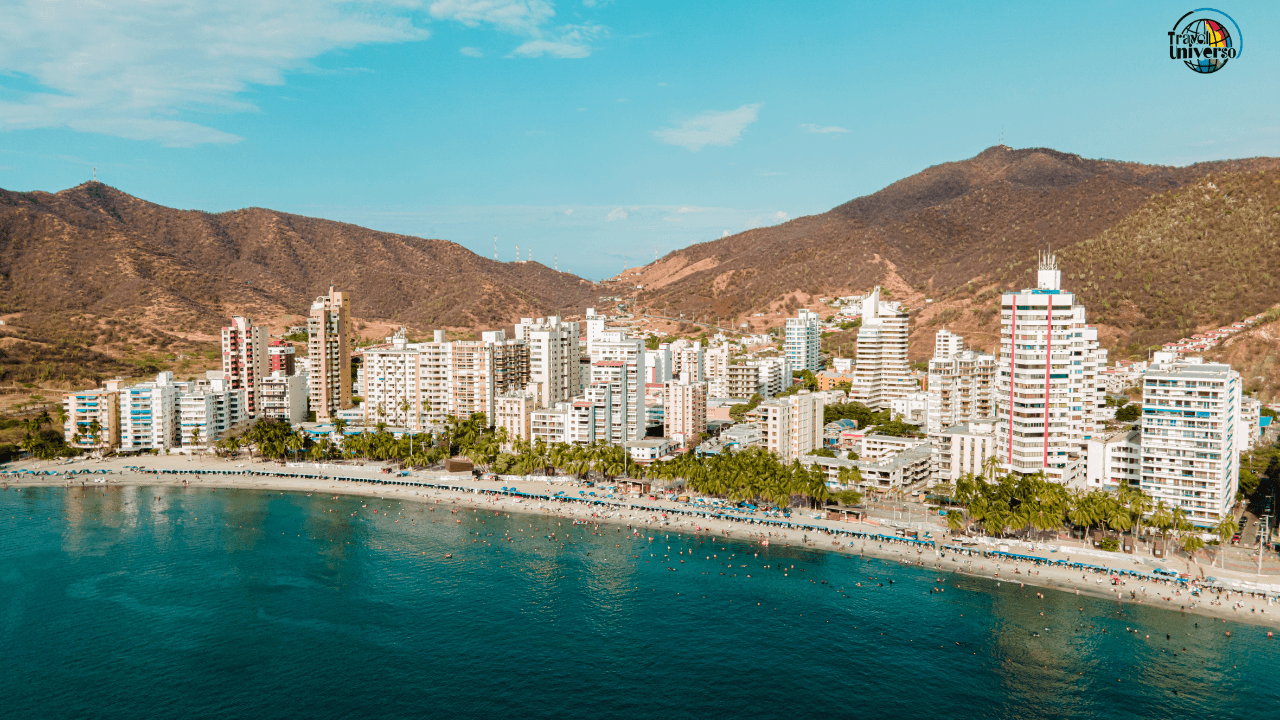
Here you'll find palm trees, tropical fruits, coffee plantations at lower elevations, cattle ranching, and coastal cultures. Cities like Cartagena, Santa Marta, Barranquilla, and Leticia exist entirely in tierra caliente. The heat is constant and inescapable—this is where visitors from temperate climates struggle most with adaptation.
For travelers, this means: lightweight, breathable clothing; serious sun protection; accepting that you'll sweat constantly; understanding that air conditioning becomes essential rather than luxury; and recognizing that the afternoon heat will slow you down whether you like it or not.
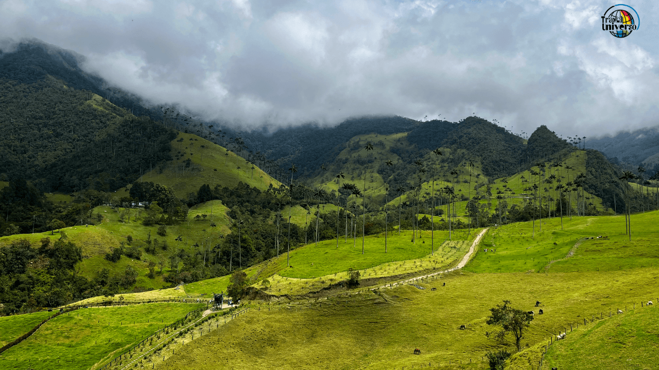
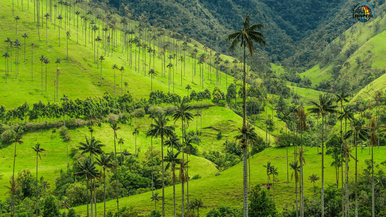
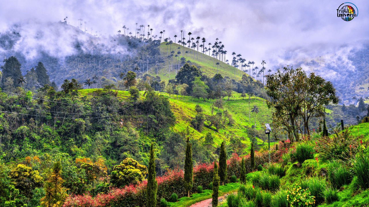
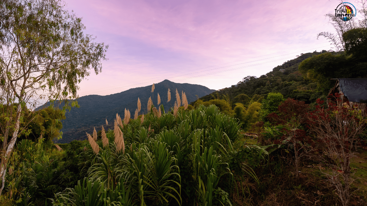
Tierra Templada (Temperate Land): 1,000-2,000 meters
The zone Colombians call eternal spring, with temperatures between 17-24°C (63-75°F). This narrow altitude band includes some of Colombia's most pleasant and productive regions. The climate remains warm enough for year-round cultivation but cool enough to escape tropical heat's intensity.
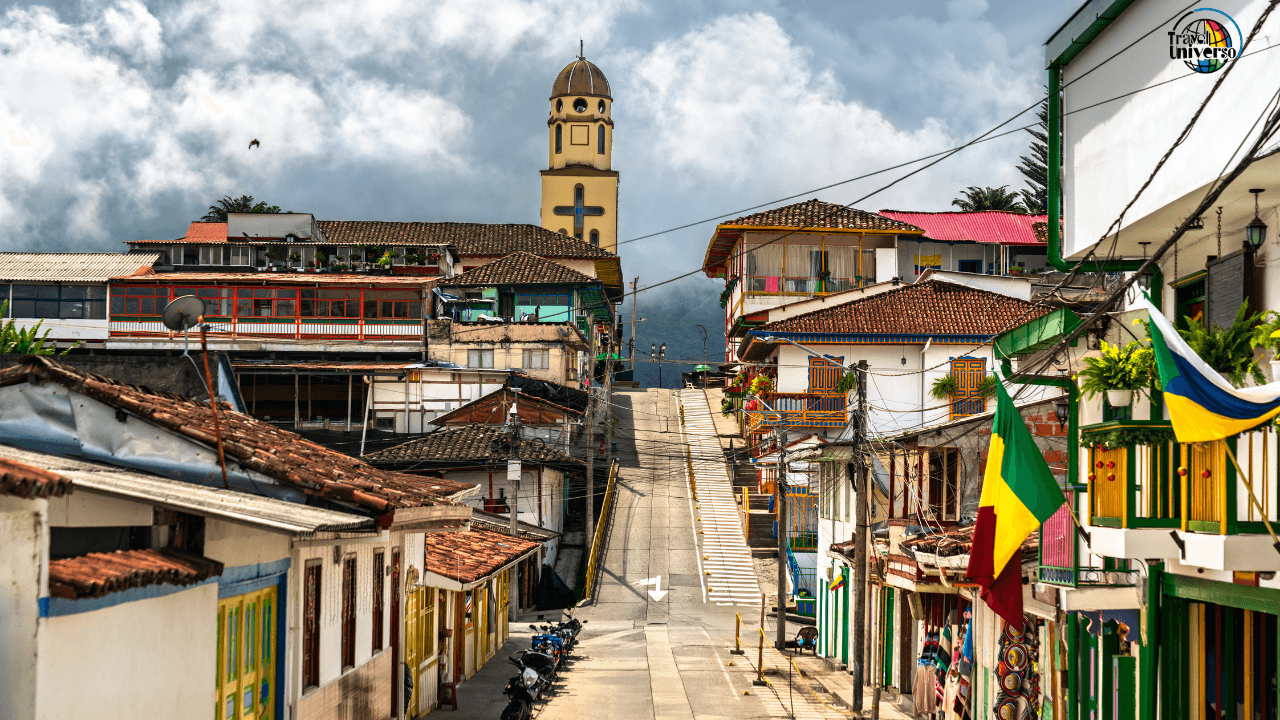
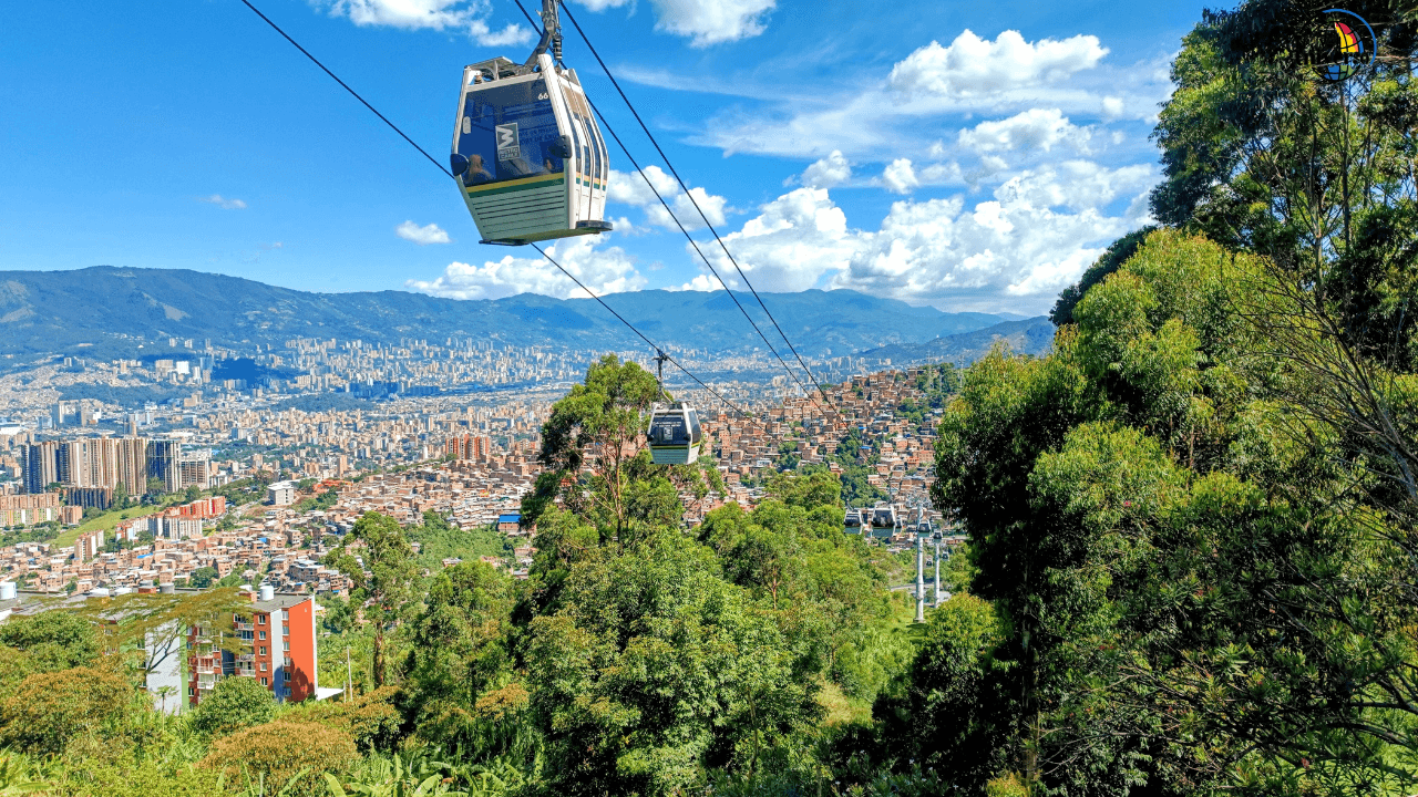
Major coffee-growing regions occupy this zone—the Zona Cafetera (Coffee Triangle) around Manizales, Pereira, and Armenia. Medellín sits at the lower edge of tierra templada, giving it the nickname "City of Eternal Spring." Parts of Bucaramanga, Cúcuta, and numerous smaller towns enjoy this ideal climate.
This zone produces the most diverse agriculture: coffee, sugarcane, maize, beans, and various fruits and vegetables. Traditional fincas (farms) here often feel like paradise—warm days, cool nights, lush growth, and comfortable working conditions.
For travelers, this zone offers relief. You can be active during midday without suffering, sleep comfortably without air conditioning, and pack moderate-weight clothing. Many visitors find tierra templada their favorite climate zone in Colombia.
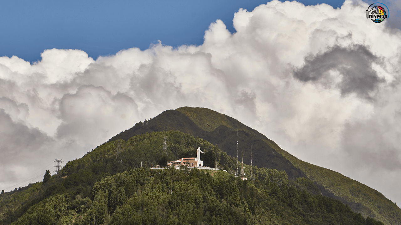
Tierra Fría (Cold Land): 2,000-3,000 meters
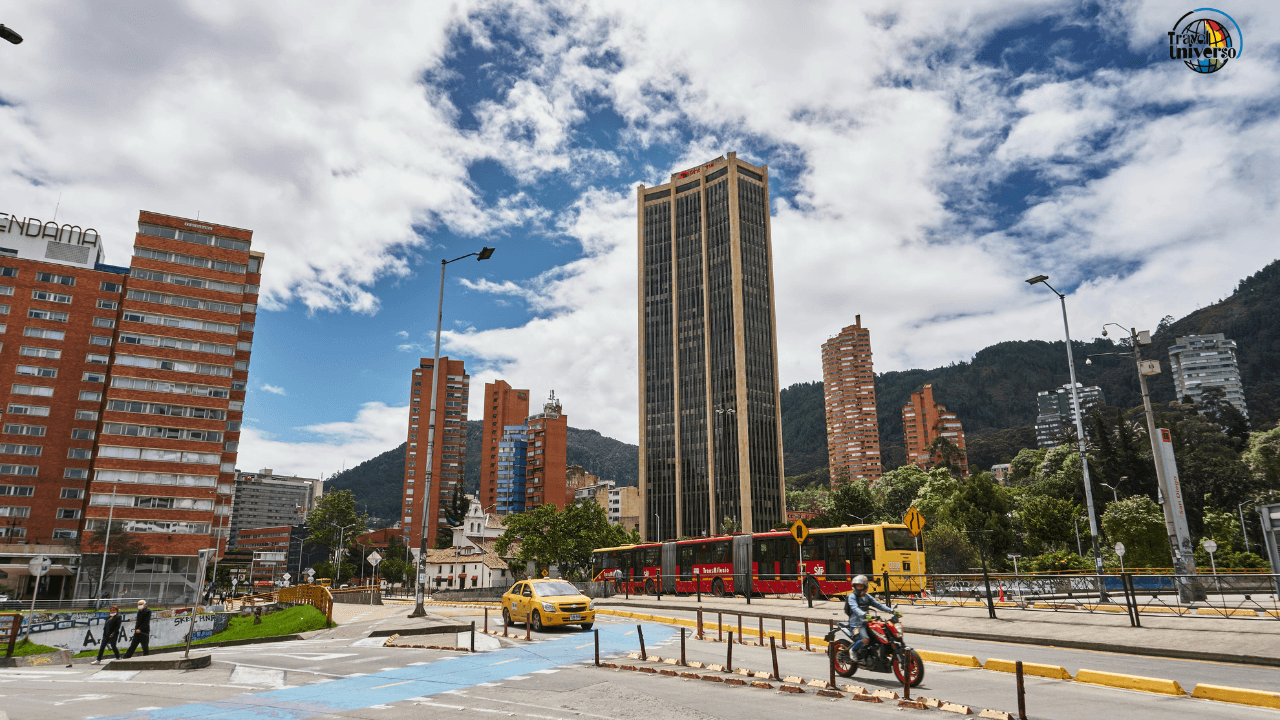
Here temperatures range from 12-17°C (54-63°F)—cool enough to need sweaters, but not truly cold by global standards. Bogotá sits at 2,640 meters, firmly in this zone, as does much of the Eastern Cordillera's population.
This zone supports different crops: potatoes, wheat, barley, and vegetables that require cooler temperatures. The landscape shifts toward grasslands, cloud forests, and páramo (high-altitude moorland) at the upper edges. Architecture changes too—houses become sturdier with smaller windows and pitched roofs, and fireplaces appear.
The altitude affects visitors beyond temperature. At 2,600+ meters, Bogotá sits high enough that some people experience mild altitude effects: shortness of breath during exertion, faster intoxication from alcohol, and occasional headaches. Most people adapt within 1-2 days, but it's noticeable.
For travelers, this means: layered clothing becomes essential; mornings and evenings get genuinely chilly; sun exposure remains intense despite cooler temperatures (UV radiation increases with altitude); and you'll need to adjust your physical expectations during your first days.
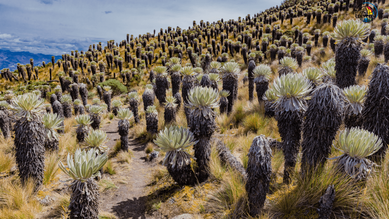
Tierra Helada (Frozen Land): 3,000-4,800 meters
Temperatures between 6-12°C (43-54°F) define this zone, where frost occurs regularly and agriculture becomes limited to hardy crops like potatoes and quinoa. Few people live permanently at these altitudes, though shepherds and farmers work here seasonally.
The landscape becomes increasingly stark and beautiful—páramo ecosystems dominate, characterized by unique plants like frailejones (espeletia), grasses, and scattered shrubs. Towns like Tunja and parts of Boyacá department touch the lower edges of tierra helada, while higher reaches remain largely uninhabited except for remote villages.
Several Colombian national parks protect páramo ecosystems in this zone: Chingaza, Sumapaz, Los Nevados, and others. These areas serve as crucial water sources—the páramos act like giant sponges, capturing moisture and releasing it gradually into rivers that supply cities below.
For travelers, this zone requires preparation similar to mountain hiking anywhere: warm layers, wind protection, understanding that weather changes rapidly, and recognizing that altitude effects become more pronounced above 3,000 meters.
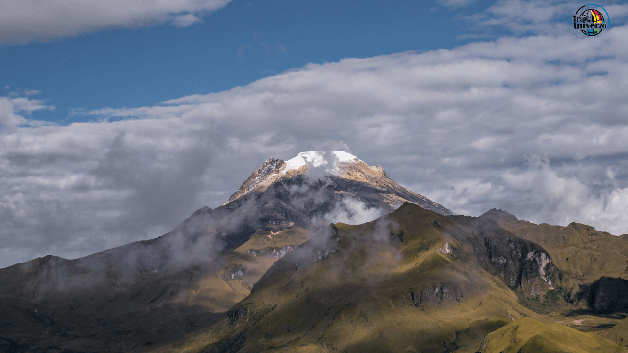
Tierra Nevada (Snow Land): Above 4,800 meters
Permanent snow and ice, with temperatures consistently below 6°C (43°F) and often well below freezing. This zone exists only on Colombia's highest peaks: Pico Cristóbal Colón and Pico Simón Bolívar in the Sierra Nevada de Santa Marta (both 5,730 meters), several peaks in Los Nevados National Park, and a few other isolated summits.
Climate change is rapidly shrinking this zone—Colombia's glaciers have lost over 80% of their extent in the past 50 years. What remains requires mountaineering skills to access and exists more as a symbol than a practical travel destination for most visitors.
Strategic Travel Planning by Climate Zone
Understanding these zones transforms how you approach Colombia. Instead of picking destinations by what they offer, you can strategically plan routes that help you adjust to altitude gradually, avoid overwhelming heat or cold, and pack appropriately.
The Coastal-to-Capital Classic: Gradual Ascent
Many visitors arrive in Cartagena (sea level, hot) then fly to Bogotá (2,640 meters, cool). This is the worst possible approach—you go from intense heat and humidity to high altitude and cool temperatures instantly, maximizing adjustment difficulty.
Better approach: Cartagena → Medellín (1,500 meters, pleasant) → Bogotá (2,640 meters, cool). This gives your body time to adjust to altitude gradually while experiencing three distinct climate zones. Each transition is manageable rather than shocking.
Even better: Cartagena → Medellín → Villa de Leyva or Guatavita (2,800-3,000 meters, coolish) → Bogotá. This adds a step at intermediate altitude in beautiful colonial towns, making the Bogotá adjustment minimal.
The Coffee Zone Advantage
The Coffee Triangle sits in tierra templada—the comfort zone. Use it strategically as a midpoint between coastal heat and highland cold. A route like Cartagena → Salento (1,900 meters) → Bogotá → back to Salento → Medellín before departing gives you pleasant climate whenever you need recovery from temperature extremes.
Salento, Filandia, and surrounding coffee towns offer perfect conditions for active tourism: hiking Valle de Cocora, visiting coffee farms, exploring towns—all without heat exhaustion or altitude symptoms. It's reset climate.
The Microclimate Day Trip
Colombia's compressed topography allows experiencing multiple climate zones in single days. From Bogotá, you can reach hot springs in tierra templada within 2-3 hours, offering warmth and lower altitude as a break from the capital's coolness. From Medellín, pueblos (towns) at various altitudes spread in all directions, allowing climate choice based on preference.
From Santa Marta (sea level, hot), you can drive to Minca (650 meters, still hot but less humid) in 45 minutes, or push to San Lorenzo (2,300 meters, cool) in 2-3 hours. You're moving through climate zones at driving speed.
Packing for Vertical Climate Travel
Conventional packing advice fails in Colombia. "Pack for tropical weather" leaves you freezing in Bogotá. "Pack for mountain climate" means sweating through Cartagena. You need a system.
The Three-Layer Strategy
Layer 1 - Base everywhere (Hot Zone):
Lightweight, quick-dry shirts and pants
Breathable underwear and socks
Sun hat and sunglasses
Sandals or light sneakers
Swimwear
This handles tierra caliente and serves as your base layer in cooler zones.
Layer 2 - Add for altitude (Temperate/Cool Zones):
Long-sleeve shirts (can be lightweight)
Long pants or convertible pants
Light sweater or fleece
Closed-toe walking shoes
Light jacket
These pieces layer over your base clothes when you hit Medellín, Bogotá, or coffee regions.
Layer 3 - Add for highlands (Cold/Frozen Zones):
Warm jacket or down layer
Gloves and warm hat
Thermal underwear if visiting páramos
Waterproof outer layer (also useful for rain at any altitude)
You might need these pieces only 20% of your trip, but when you need them, you really need them.
The Compression Strategy
Pack base layer and Layer 2 items in your main bag. Put Layer 3 (bulky warm items) in compression bags or packing cubes. They compress small, deploy quickly when needed, and don't take much space when you're spending days at lower altitudes.
Many experienced Colombia travelers keep a small daypack with a sweater and light jacket accessible while touring Bogotá or highland areas, leaving the rest of their warm gear at the hotel. You can shed/add layers as you move between indoor (often heated) and outdoor spaces.
What Not to Pack
Skip single-climate wardrobes entirely. Don't pack purely tropical clothes assuming Colombia is uniformly hot. Don't pack serious winter gear unless specifically mountaineering. You want versatile pieces that work across zones.
Skip cotton if possible—it absorbs sweat and takes forever to dry in humid zones, but also provides no warmth when wet in highland zones. Synthetic or merino wool pieces perform better across Colombia's climate variations.
Climate-Specific Activities and Timing
Beach and Coast (Tierra Caliente)
Best time: December-March (drier, slightly less humid) Activities: Beach time, scuba diving, coastal old town exploration, mangrove tours Reality check: You will be hot and sweaty constantly. Plan major walking/exploring for early morning or late afternoon. Midday is for beaches, pools, or air-conditioned museums.
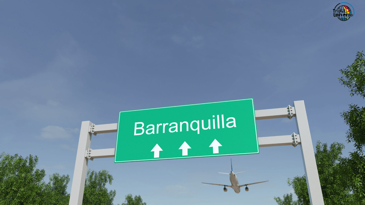
Coastal cities like Cartagena, Santa Marta, and Barranquilla are furnaces from midday to late afternoon. Locals adapt by working early and late with long lunch breaks. Tourists who fight this schedule suffer—embrace the rhythm instead.
Coffee Region (Tierra Templada)
Best time: Any time (genuinely year-round destination) Activities: Coffee farm tours, Valle de Cocora hikes, colonial town exploration, thermal springs Reality check: This is the Goldilocks zone—not too hot, not too cold, nearly perfect for active tourism. If you're unsure where to base yourself in Colombia, choose here.
Rain occurs year-round but typically as afternoon showers. Morning activities are reliably dry. The climate allows all-day activity without the heat exhaustion risk of coastal areas or altitude concerns of highland regions.
Bogotá and Highlands (Tierra Fría)
Best time: December-February, June-August (drier seasons) Activities: Museums, city exploration, day trips to surrounding highland towns, páramo hiking Reality check: Bring layers. Bogotá's altitude makes it feel colder than the thermometer suggests, especially combined with wind and rain. Indoor spaces are often poorly heated by North American/European standards.
The altitude affects your alcohol tolerance significantly—one drink in Bogotá hits like two at sea level. Stay hydrated, drink slowly your first day or two, and don't be surprised if you get tipsy faster than normal.
Páramo Ecosystems (Tierra Helada)
Best time: Dry season within the region you're visiting (varies by location) Activities: Hiking, photography, nature observation, visiting unique high-altitude villages Reality check: Weather changes rapidly. Bring sun protection (UV is intense), warm layers (temperature drops quickly), rain gear (storms appear suddenly), and understand that physical exertion at 3,500+ meters is significantly harder than at lower altitudes.
Many páramo areas are in national parks with entrance fees and sometimes permit requirements. Popular parks like Chingaza and Los Nevados fill up on weekends—visit midweek for better experiences.
Climate-Related Health Considerations
Heat Management in Coastal Zones
Heat exhaustion is real. Symptoms include excessive sweating followed by suddenly stopping sweating, dizziness, rapid heartbeat, and nausea. Prevention is straightforward: drink water constantly (more than feels necessary), seek shade during peak heat, and slow down your pace.
Coastal Colombia's humidity means sweat doesn't evaporate efficiently—you stay wet and uncomfortable. Embrace it. Change clothes midday if possible. Use hotel pools or beaches for regular cooling. Accept that you'll shower 2-3 times daily.

Altitude Adjustment in Highland Zones
Bogotá sits high enough that some visitors experience soroche (altitude sickness): headaches, nausea, dizziness, or shortness of breath. Most people adjust within 24-48 hours. Strategies that help:
Arrive in the afternoon/evening, rest immediately, sleep your first night there
Avoid alcohol your first day at altitude
Drink extra water (altitude causes increased urination and breathing moisture loss)
Eat lighter meals your first day or two
Avoid intense exercise your first day—walk slowly, rest frequently
If symptoms persist beyond two days or worsen, descend to lower altitude. For most travelers in Bogotá, mild symptoms resolve quickly once you adjust.
Sun Exposure Across All Zones
UV radiation near the equator is intense at any altitude, but becomes more intense as you climb. Sunburn happens fast in Colombia—30 minutes of midday sun at 2,600 meters can burn unprotected skin. Wear sunscreen daily (SPF 30+), reapply every few hours, and don't assume cloudy days are safe—clouds block light but not UV effectively.
Temperature Shock Management
Moving between climate zones can stress your body. Going from hot Cartagena to cool Bogotá within hours can suppress immune function temporarily. Give yourself adjustment time between major climate changes if possible. If you feel run down after big temperature transitions, rest an extra day—your body needs it.
Leveraging Climate Zones Like Locals
Colombians instinctively use their country's vertical climate zones for recreation and escape. Wealthy Bogotá residents maintain weekend homes in tierra templada (Melgar, Girardot, Anapoima) where they escape the capital's coolness for warmth and lower altitude. Coastal residents vacation in highland towns to escape oppressive heat. You can do the same.
Weekend Climate Escapes from Major Cities
From Bogotá (cool):
Girardot (1 hour, hot): Beach town feeling without actual ocean, pools and river, escape from altitude
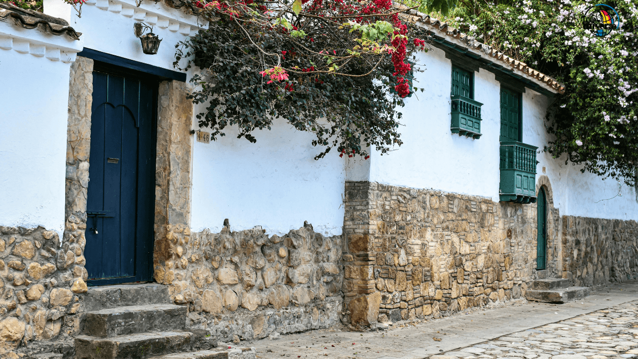
Villa de Leyva (2.5 hours, similar altitude but sunnier): Colonial town with warmer microclimate
Melgar (2 hours, warm): Pool resorts, tropical fruit, lower altitude relaxation
From Medellín (pleasant):
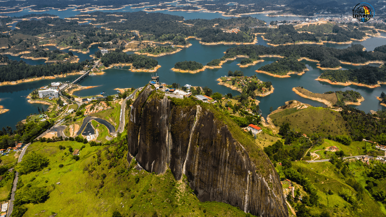
Guatapé (2 hours, slightly cooler): Lakes, colorful town, mild highland feel
Santa Fe de Antioquia (1.5 hours, hot): Colonial town in warm valley, traditional architecture
Jardín (3 hours, cooler): Cloud forest mountain town, trout farms, waterfalls
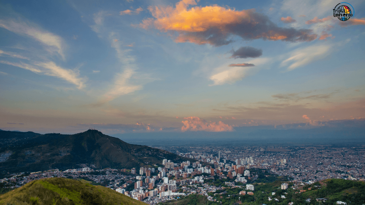
From Cali (hot):
Popayán (2 hours, cool): White colonial city at 1,738 meters, cultural richness
Buga (1 hour, similar): Religious tourism, warm valley location
These aren't just tourist destinations—they're climate relief systems that Colombians use regularly.
Strategic Multi-City Itineraries
Design your route to use climate zones strategically rather than fighting them:
The Cool-to-Hot Finish: Bogotá → Villa de Leyva → Barichara → Bucaramanga → Minca → Cartagena
Start cool and high, gradually descend, finish at beach. Your body adapts to decreasing altitude easily, and ending at the beach provides relaxing conclusion.
The Temperature Moderation Route: Bogotá → Salento → Medellín → Guatapé → Cartagena
Use the Coffee Zone as a climate buffer between Bogotá's altitude and the coast's heat. Medellín provides another pleasant stop. This route never gets too cold or too hot.
The Adventurer's Variety Pack: Santa Marta → Tayrona → Minca → Bogotá → Villa de Leyva → Cocuy → Salento → Medellín
Experience everything: Caribbean beaches, jungle, cloud forest, high altitude capital, páramo ecosystems, coffee country, and eternal spring city. This requires stamina and flexibility but showcases Colombia's climatic diversity completely.
Seasonal Considerations (What Little They Exist)
Colombia doesn't have four seasons—it has wet and dry seasons that vary by region and are complicated by altitude. Understanding this prevents disappointment.
Caribbean Coast: Dry season: December-March, June-August Wet season: April-May, September-November Reality: Even "dry" season has occasional rain; "wet" season isn't constant rain, just more frequent showers.
Andean Highlands: Two dry seasons: December-February, June-August Two wet seasons: March-May, September-November Reality: Rain possible any month; dry seasons are more reliable but not guaranteed.
Amazon Region: Less distinct seasons; rain possible anytime Slightly drier: June-September Wetter: March-May
Coffee Region: Harvest season: October-November (main), April-May (secondary) Reality: Rainfall year-round, typically afternoon showers. Little seasonal variation in temperature—always pleasant.
The key insight: Colombia's climate variations come from geography (altitude) not seasons. Pack for altitude zones, not for time of year.
Making Climate Diversity Your Advantage
Most countries force you to accept whatever weather exists during your visit. Colombia offers options. Too hot in Cartagena? Escape to Bogotá for a few days. Finding Bogotá too cool and rainy? Drop down to the Coffee Zone. This flexibility is unique and valuable.
Build climate relief into your itinerary. If you know you struggle with heat, don't spend your entire trip on the coast—break it up with highland stops. If cold weather depresses you, avoid spending your whole trip in Bogotá—schedule temperate zone breaks.
The vertical climate zone system that initially seems confusing becomes Colombia's secret weapon once you understand it. Instead of fighting climate, you choose it. Instead of suffering through uncomfortable temperatures, you move to comfortable ones. Instead of packing inadequately and struggling, you pack systematically for all zones and deploy layers strategically.
This is how Colombians think about their country—not as one climate but as many, all accessible, all available, separated by hours of travel rather than seasons of waiting. Once you adopt this mindset, Colombia transforms from climatically intimidating to climatically empowering. You're not at the weather's mercy—you're choosing from a menu of climates that includes nearly every option Earth offers, all within one remarkably diverse country.
Get our travel tips, itineraries and guides by email
Sign up for my newsletter!
Name
Let us know what you think in the comments!
Newsletter
Subscribe to the newsletter and stay in the loop! By joining, you acknowledge that you'll receive our newsletter and can opt-out anytime hassle-free.
© 2026 Travel Universo. All rights reserved.